 Forward
 Twitter
 Google+
 LinkedIn


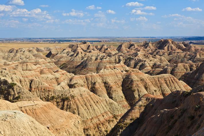
Various colored hills are surrounding here.
This is the Painted Desert.

Painted Desert
The Painted Desert is a desert of badlands area in the Four Corners area from Grand Canyon National Park into Petrified Forest National Park. Much of the area is inside the Navajo Nation.
Encompasses more than 93,500 acres, it stretches over 160 miles from about 30 miles north of Cameron (Arizona), near the rim of the Grand Canyon, to the Petrified Forest about 26 miles east of Holbrook (Arizona). It neighbors the Wupatki National Monument Indian Ruins part of the way. The area derives its name from the wide range of colors from lavender to shades of gray with vibrant sections of reds, oranges, and pinks. The long expanse of hills and buttes forms a beautiful landscape of a rainbow of colors in the barren landscape.
From the combination of erosion, water, and silica, the remnants of a once magnificent pine forest have taken millions of years to resurface and sparkle like diamonds. The area of the Petrified Forest was once the home of dinosaurs and other prehistoric residents. Holding the largest known concentration of petrified trees, this National Park also provides an opportunity to explore the lives of ancient Indian tribes who once lived in this area. The Puerco Pueblo and Agate House sites stand as monuments of the ingenuity of these ancient tribes.
While life went on here among the painted peaks, modern civilization didn’t begin to discover its existence until the 16th century when Spanish explorers passed through the area. They named it "El Desierto Pintado" for the colorful horizon. From that point, many others passed through, but few stayed. Starting from the 1800s, visitors increased, from military personnel, ranchers, and tourists.
The picture is of Petrified Forest National Park.
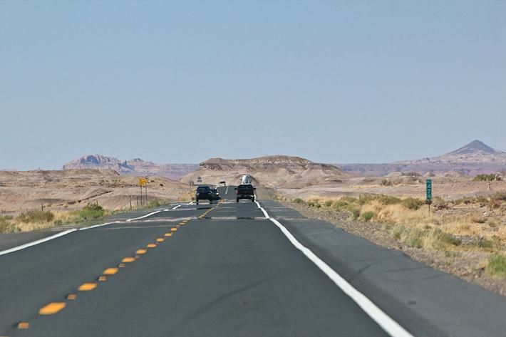
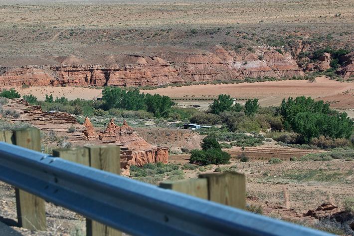
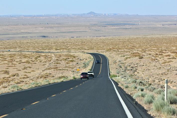
Once you get on SR-264, it is the way to Coal Mine Canyon.
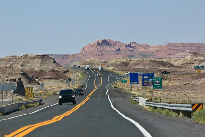
SR-264 scenery
The scenery of SR-264 passing by the center of the Painted Desert won’t disappoint tourists.

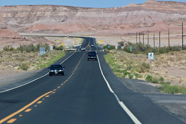
Red colored hills are continuing.

There are a river and stream.
And the desert area continues.
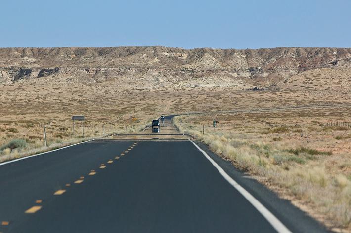
It never gets boring and it’s a great road to drive.

Between milepost 336 and 337, there is a 2-story house and a windmill next to it.
GPS coordinates: 36.013005, -111.047058

It is difficult to find since there is no road sign on the way.
From the above coordinate area, there is an off-road on the left. Take that road about a half mile and a canyon will appear suddenly.

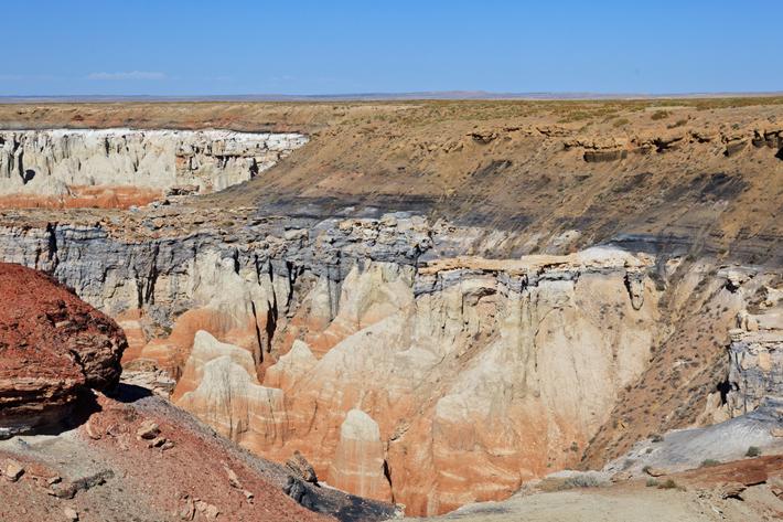
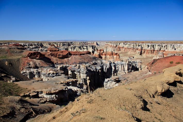
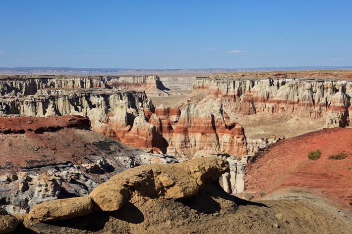
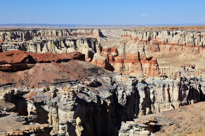
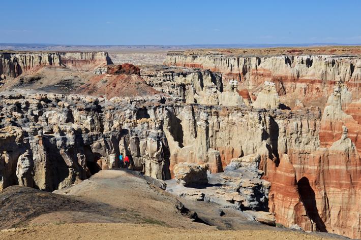
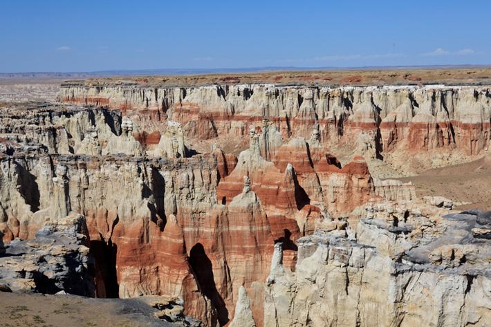
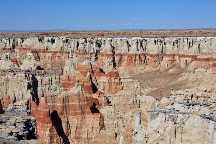
It is Coal Mine Canyon. You cannot find Coal Mine Canyon on the map, so only people who know this place come here. There a black coal every once in a while on the way to Coal Mine Canyon. That explains where the name comes from.
Coal Mine Canyon
In the vast desert of northeast Arizona, along the border between the Hopi and Navajo Indian Reservations, Coal Mine Canyon is far from any famous attractions. It is not marked in any way, yet it has become quite well known because of the amazingly colorful formations that line the upper part of the canyon. Like many remote and little-visited sites in the Southwest, the canyon’s interest comes from the details of the rock (the colors, forms, and textures of the eroded sandstone) rather than the large scale appeal of grand places like Zion National Park and Monument Valley. Coal Mine Canyon sits at the edge of the Painted Desert, a sparsely settled region without many roads, but covered by extensive areas of exposed, weathered rock, many of which have similar details.
Visitors can view various shapes made from a long time of erosion. All the shapes that tourists can view at Bryce Canyon, Cedar Breaks, and Red Rock Canyon are here in Coal Mine Canyon.
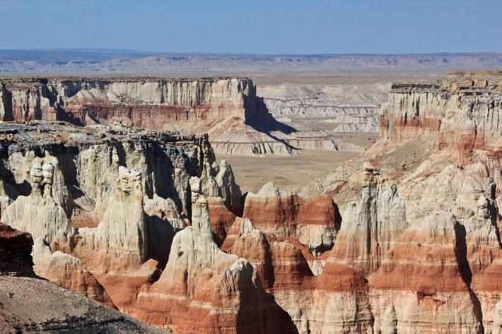
Coal Mine Canyon is not that deep and spread out about 4 miles.

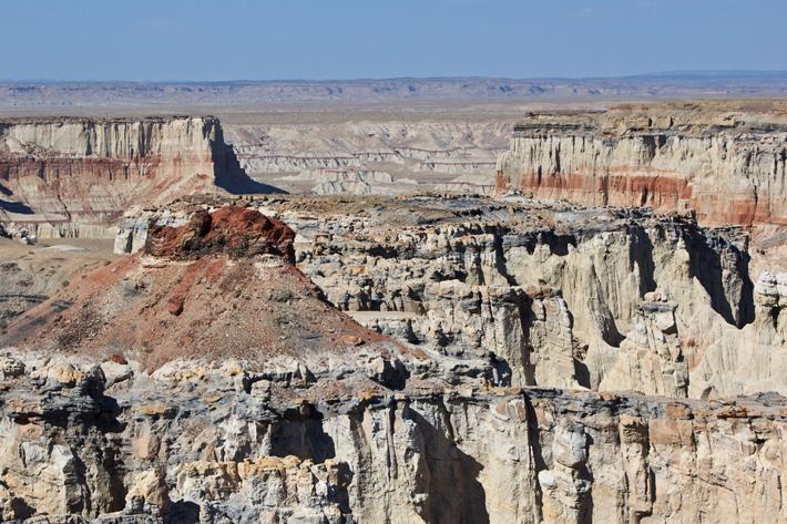
Coal Mine Canyon is where visitors can enjoy various shapes of erosions from famous tourist areas.
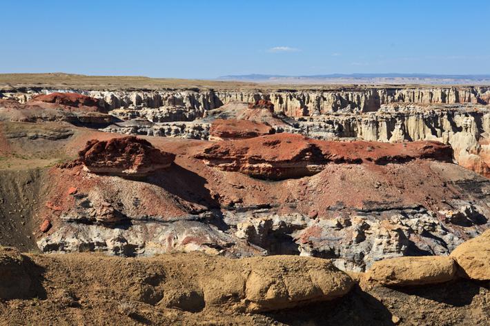
The main colors are red, white, and gray.

I can see my friends over there.
There were no other people there other than us.
These colorful shapes are amazing at sunset.
But unfortunately, we had to head out to the next location before sunset.
There was a picnic table.
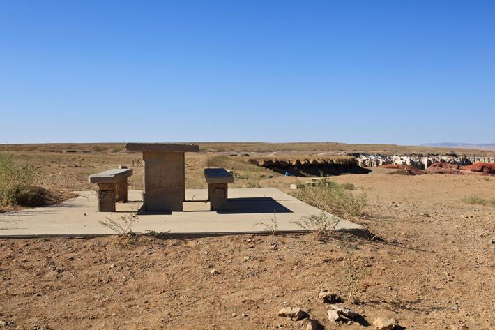
Looking at Coal Mine Canyon one more time to remember it.
Then headed out to Navajo National Monument.
*This posting was translated. Click here to read the original version.