Monument Valley Navajo Tribal Park- 1: Agathla Peak & Visitor Center (Page, AZ)
Primary tabs
 Forward
 Twitter
 Google+
 LinkedIn

Type:
- Places

Monument Valley Navajo Tribal Park is neither a national park nor a state park. It is located within an Indian reservation, so it often does not show on the map without enlarging the area.
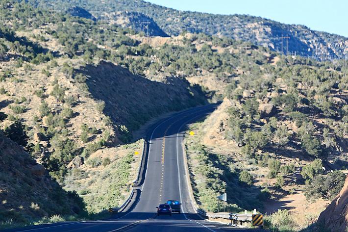
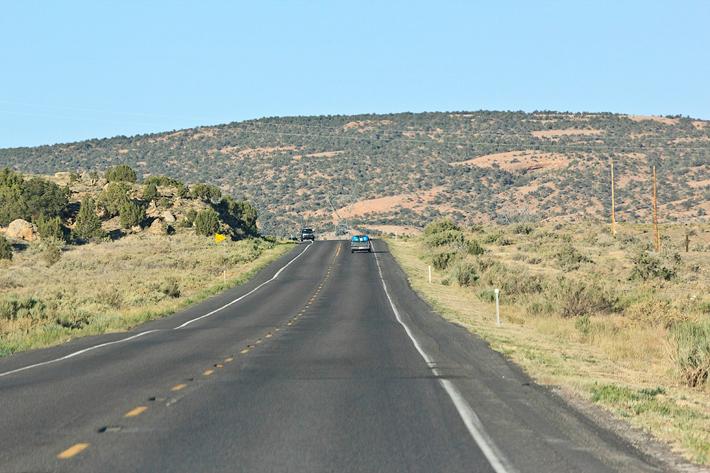
The pictures are of the scenery on US Route 163 to Monument Valley Navajo Tribal Park.
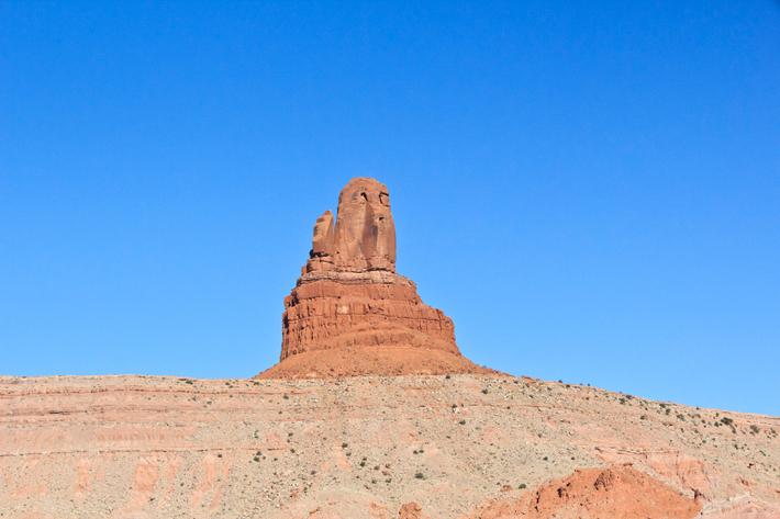
Close to Monument Valley, the 1500-foot (457 m.) height of Agathla Peak is standing as if a guard.
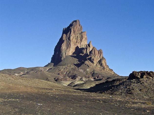
Agathla Peak
Agathla Peak (El Capitan in Spanish) south of Monument Valley rises 1,500 feet (457 m.) above the surrounding terrain and is visible from US-163.
Geologically, Agathla Peak is an eroded volcanic plug consisting of volcanic breccia (clastic sedimentary rocks composed of large angular fragments with he spaces between the filled with a matrix of smaller particles or a mineral cement binding the rock together) cut by dikes of minette (an unusual igneous rock). It is one of several volcanic diatremes found in Navajo country of northeast Arizona and northwest New Mexico.

This picture of Agathla Peak was taken while driving looked almost like a face of a human.
Agathla Peak of picture in this direction look like accumulated wool (much wool) and deer like the name indicates.
The English name of Agathla is derived from the Navajo name aghaałą́ (meaning "much wool," for the amount of fur from antelope and deer accumulating on the rock). The formation is considered sacred by the Navajo.
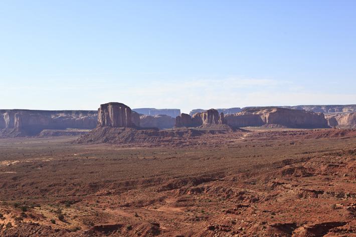
The sublime scenery of Monument Valley started to reveal itself in the far distance.
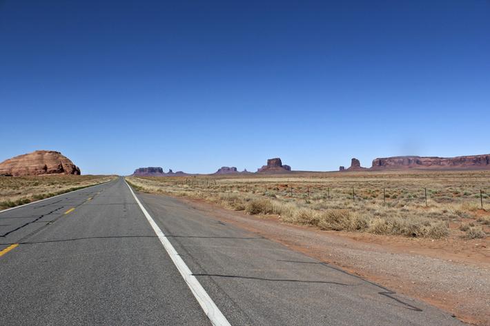
Closer to Monument Valley, large mesas were showing.
A mesa is the American English term for an elevated area of land with a flat top and steep cliffs for sides, taking its name from a characteristic tabletop shape. Mesas are larger than buttes, although otherwise resemble them closely.

We parked shortly at the entrance gate and imagined the sceneries of Monument Valley.
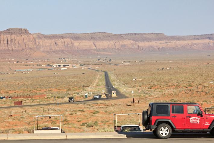
The entrance fee rose to $20 from $5 per car. After the fees were raised, real park brochures have been handed out to the visitors instead of a printed out paper map.
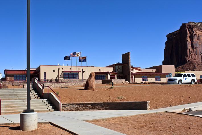
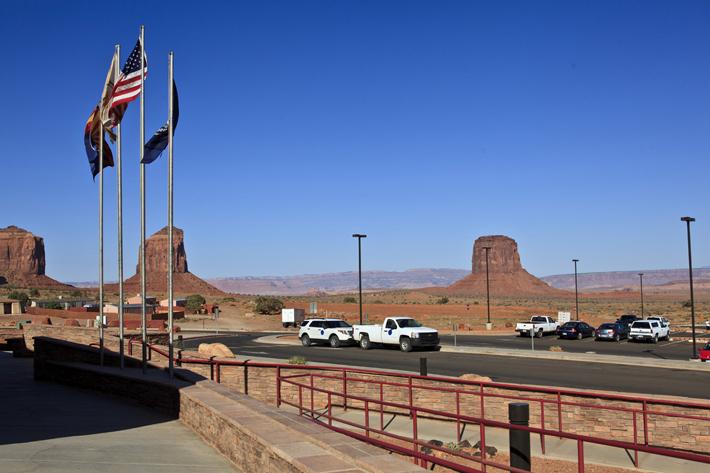
We arrived at the visitor center and the famous View Hotel is located right behind the visitor center.
Monument Valley
Monument Valley is a region of the Colorado Plateau with several tall sandstone buttes, some of which range as high as 1,000 ft (300 m.) above the surrounding valley. Located on border between Arizona and Utah state line, it is somewhat near the Four Corners area (border of Colorado, Arizona, Utah, and New Mexico). Located within the Navajo Nation Reservation, it is accessible by U.S. Highway 163.
Monument Valley officially consists of the area expanse that includes much of the area surrounding Monument Valley Navajo Tribal Park (a Navajo Nation equivalent to a National Park) and Oljato. Visitors enter the area by paying an access fee and can drive through much of the park on a 17-mile (27 km.) dirt road (usually taking 2-3 hours). Some sections (such as Mystery Valley and Hunts Mesa) are accessible only with a guided tour.
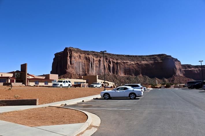
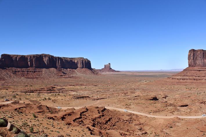
The picture is from the parking lot of the visitor center, with Mitchell Mesa on the right.
Huge buttes were unfolding in Monument Valley.
A butte is an isolated hill with steep (often vertical) sides and a relatively small and flat top. Buttes are smaller in scale than mesas, plateaus, and table landforms.
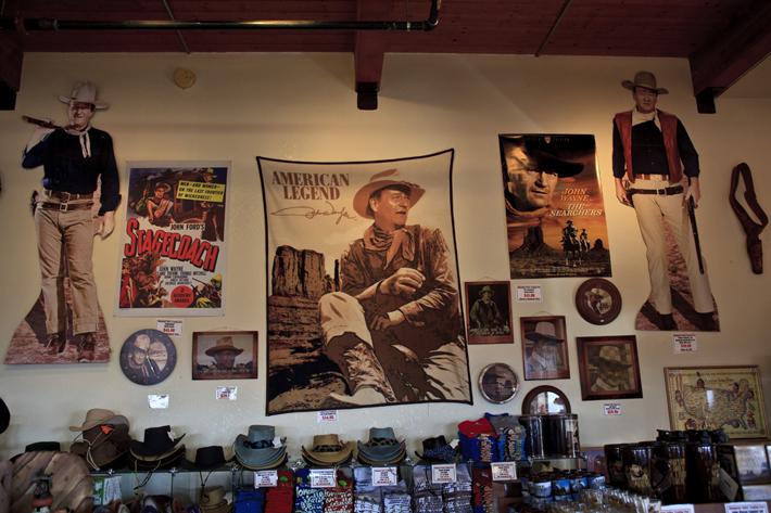
John Wayne and Stagecoach movie posters were at the souvenir store in the visitor center. I still remember John Wayne’s way of talking and walking and his yellow scarf in the movie.
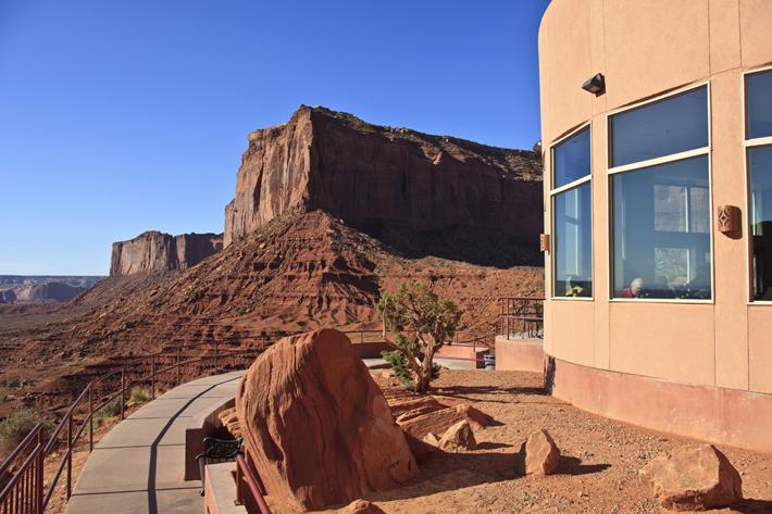
This was the view from the observation area in front of the View Hotel restaurant. Large Mitchell Mesa was right in front of us.
This was the view of the left side from the same spot.
There is a large observation area outside of the hotel for tourists. This is a place where many visitors take souvenir pictures. The picture is a German tour group.
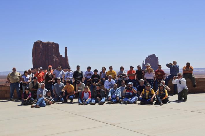
I rarely take pictures of me. But I couldn’t resist this place.
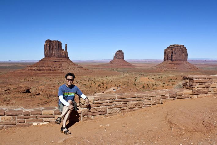
This is a front view from the observation point.
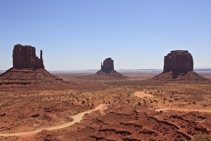
The red land looks darker in the picture since this was taken in the morning.

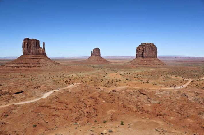
This picture taken in the afternoon shows better color- closer to the real color.
The butte on the left is West Mitten Butte (6,175 ft. / 1,882 m. above sea level), East Mitten Butte (6,227 ft. / 1,898 m.) is on the right, and Merrick Butte (6,207 ft. / 1,892 m.) is in the center.
You can compare the grandness of these buttes with the cars n the picture.
The Monument Valley area is part of the Colorado Plateau. The valley floor ranges from 5,000 to 6,000 feet (1,500 to 1,800 m.) above sea level, with many buttes rising above the floor. The floor is mostly composed of siltstone of the Cutler Group (or sand derived from it), deposited by the rivers that carved out the valley. The area gets its red color from the iron oxide exposed in the weathered siltstone. The darker, blue-gray colors come from manganese oxide.
The picture is the right side view from the observation area.

Further right side view.

The left side view.
Further left side view. There is a small rock in front of a person in the picture.
The picture taken in front of this rock is below.

This picture was taken in front of the rock.

*This posting was translated from a Korean post. Click here to read the original version.